Our Point Cloud Scanning Service delivers highly accurate, data-rich 3D representations of physical environments, enabling precise measurement, modelling, and analysis for a wide range of industries. Using advanced laser scanning and photogrammetry technologies, we capture millions of spatial data points to create detailed digital models of buildings, infrastructure, assets and landscapes.
Listed prices per sqm include:
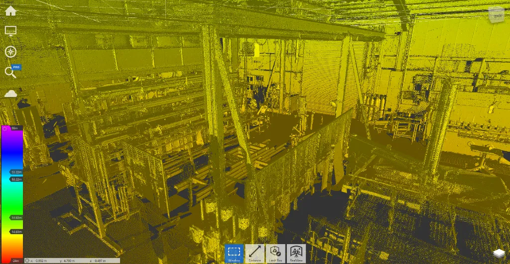
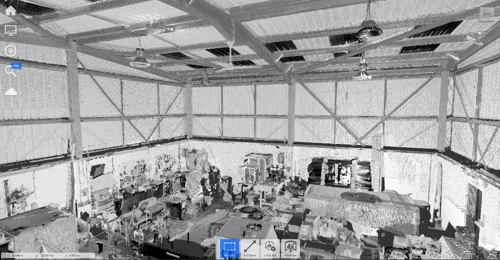
Collect a combination of grey-scale and colour laser scan data for the area indicated in client brief.
Data captured with terrestrial Laser Scanners for increased accuracy.
Production of "Realview" panoramic tour for use in Recap from the scanned positions.
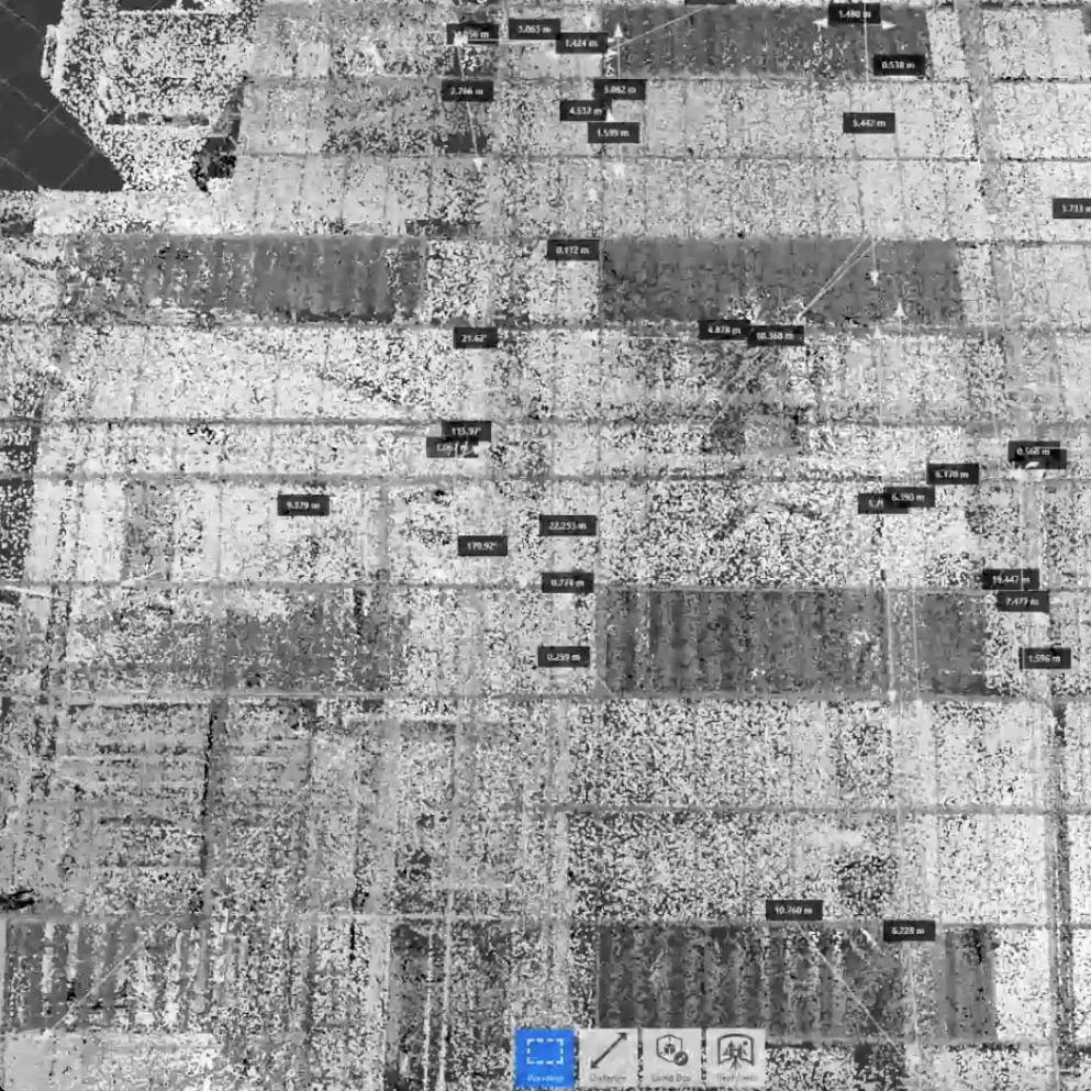
Data will be registered and indexed in RCP Point Cloud format for use in Autodesk applications, other
formats can be exported if necessary.
Survey data position will be controlled using calibrated 1" Total Stations and tied to topographical or
previous building control if available, otherwise will be positioned on OSGB36 using GPS/RTK as best
available by the survey area environment.
Finished RCP file and accompanying support folders to be issued via internet transfer.
Assumed full and free access to the building
The standard costs do not allow for capturing above suspended ceilings or other confined spaces. This is possible, please, ask prior to survey date if required.
Optional External Surveys:
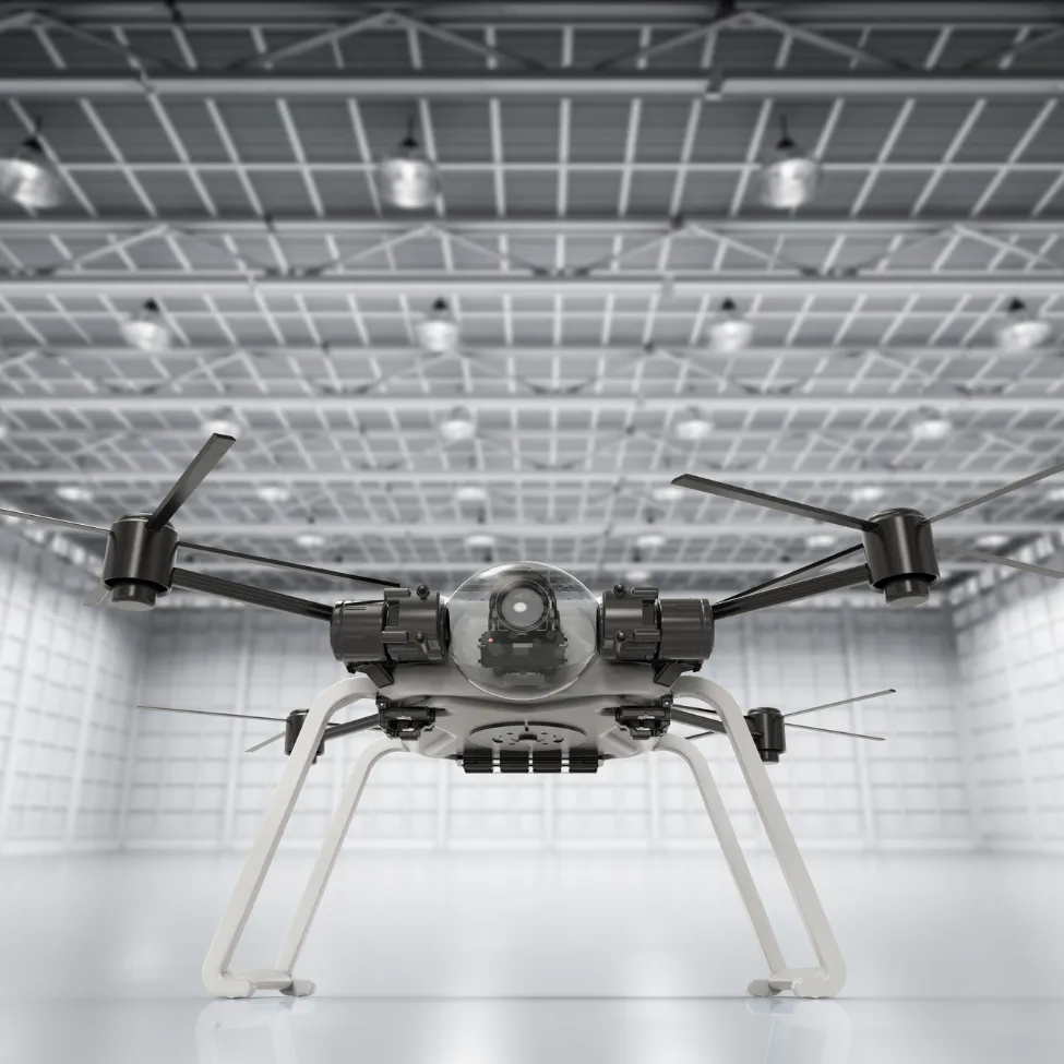
Will be produced from our own captured Aerial Drone Survey
Issued in fully coloured 3D mesh Format
3D mesh Hosted on online platform for 3 months, can be extended if required.
Production of Orthographic Site Plan to required scale.
Rapid delivery time, typically 1 day following site survey for smaller projects
Survey grade positional accuracy to suit a given purpose.
Detail captured that may not be visible from ground-level surveys, such as inaccessible roofs or low-level fenestration in private gardens.
Can be used to produce more intelligent massing models of large areas.
All external urvey information will be captured from 50m Above Properties outside of our control to ensure
Privacy Laws are adhered to.
* Point Cloud Data Available from Drone Survey for use in CAD software (We can help with additional
post-processing if required
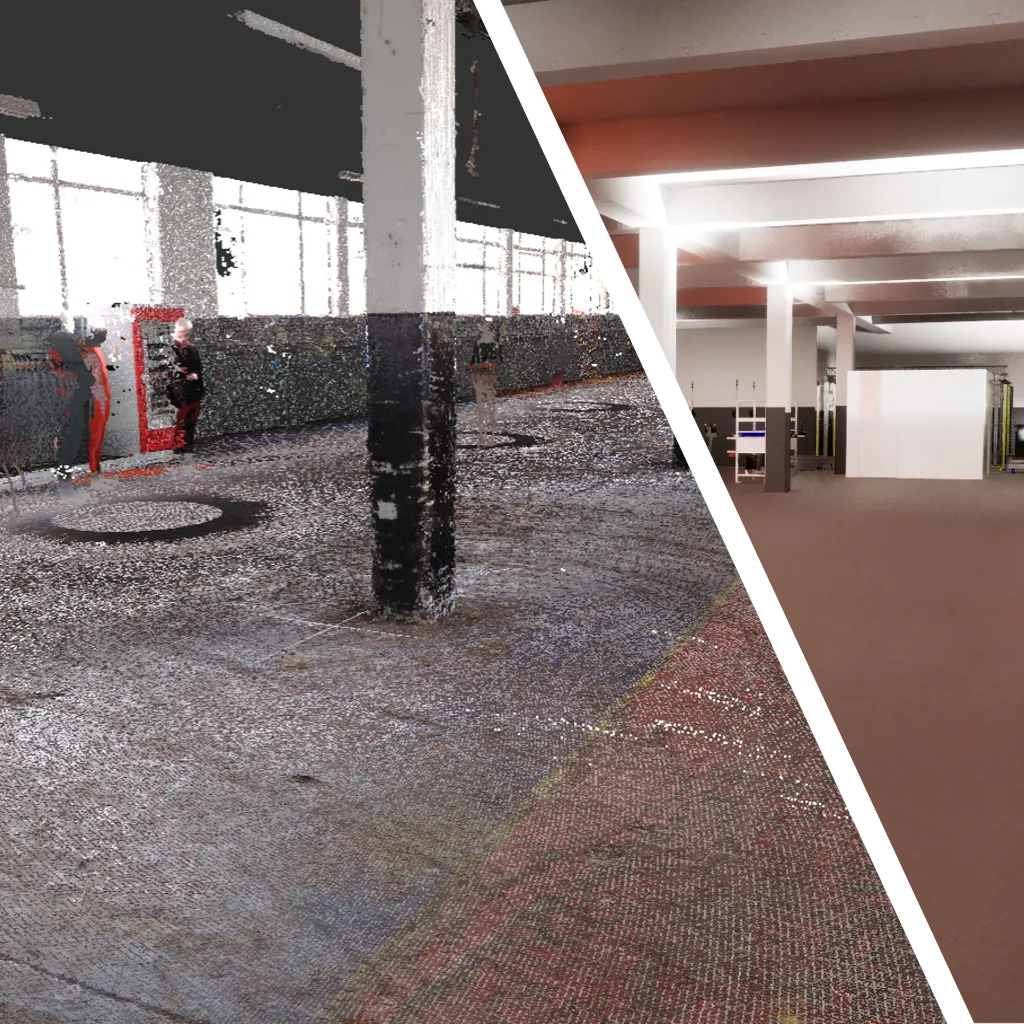
What is Point Cloud Scanning?
Point cloud scanning involves the use of 3D laser scanners or imaging devices to collect dense sets of coordinates (points) representing surfaces and structures in a physical space. The resulting “point cloud” provides a comprehensive, true-to-scale digital replica of the scanned environment.
Our Services Include
High-Precision 3D Laser Scanning
Capture accurate spatial data with millimetre-level precision using industry-leading equipment.
Photogrammetry & Drone Surveys
Combine aerial imagery with ground-based scanning for complete coverage of complex or large-scale sites.
Data Processing & Registration
Align and clean scan data into a unified, georeferenced point cloud ready for use.
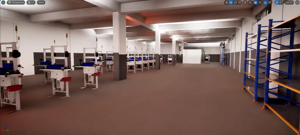
3D Modelling & BIM Integration
Convert point clouds into CAD drawings or Building Information Models (BIM) for design, construction, or asset management.
As-Built Documentation
Deliver accurate records of existing conditions to support renovations, expansions, or compliance.
Key Benefits
- Reduce errors and rework with precise spatial data
- Rapid data capture compared to traditional surveying
- Improve Collaboration, share digital models across teams and stakeholders
- Enhanced Planning and informed decision-making with comprehensive site insight
- Risk Reduction through identification of potential issues early in the project lifecycle
Applications
Our point cloud scanning services are ideal for:
- Architecture, Engineering, and Construction (AEC)
- Heritage preservation and documentation
- Facilities and asset management
- Infrastructure inspection and maintenance
- Industrial plants and manufacturing environments
- Logistics, scientific and education
Deliverables
Depending on your needs, we provide:
- Raw and processed point cloud files (e.g., LAS, E57)
- 2D drawings (plans, elevations, sections)
- 3D models (CAD, Revit, IFC formats)
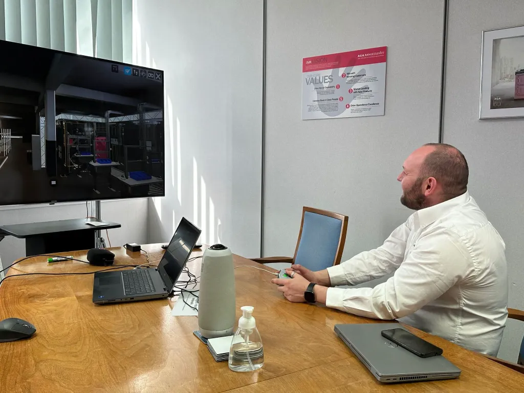
- Visualisations and walkthroughs
- Desktop and web apps with specific custom functionality, physics and ergonomics simulation, process simulation, ability to overlay current vs future state and iterations.
Our goal is to provide reliable, high-quality spatial data that supports smarter decision-making and more efficient project execution. Whether you need a small building scanned or a large, complex site documented, we tailor our service to meet your specific requirements.